Kharaneh IV
Item Set
Items
-
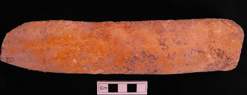 Ochre-Stained Flint Nodule from Square BS58, Bag 50, Locus 036. Flint nodule found placed vertically in a post-hole within deep trench BS58 (2010), Early Epipalaeolithic context. Nodule appears to have a possible handprint in red ochre around it. See description in Maher et al. 2016 (Occupying Wide Open Spaces). See also the field notes from KHIV.BS58 (field notes and sections for Bag 50, Locus 036 for context of nodule in post-hole).
 -
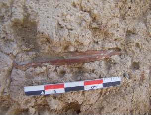 Hut 1 Worked Bone Point Polished bone point found on middle floor (Locus 270) of Hut Structure 1.
 -
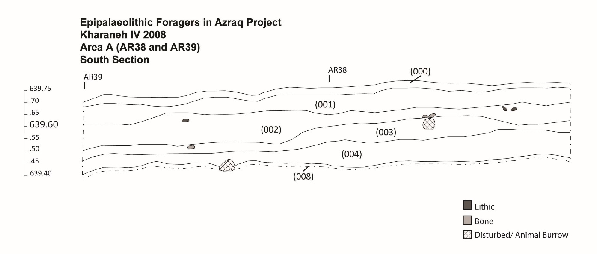 Locus 008: Area A compact Surface Locus 008 is a compact surface and with a notable decrease in large flints and bone and likely represents that same living surface that Muheisen reported from his 1985 excavations in this area. This compact surface appears at 35 cm below the surface. This surface containing, again, lots of charcoal, articulated bone (but smaller), three mandibles (gazelle-sized), a notable shift from all types of flints to microliths (particularly the trapeze/rectangles). This locus also contained shell and one fragmented piece of incised stone. The compact surface of Locus 008 is found in all of the northern excavations units, but does not continue into the southwestern units exposed this year where the complicated sequence of postholes and hearths occur. Locus 008 contains very large pieces of flat-lying articulated bone and lithics. Beneath 008 is compact sediment with a high density of charcoal and flat-lying material similar to the sediment surrounding the lower hearth. This sediment needs to be explored further in upcoming seasons but appears to be a compact surface, possibly an ash dump.
 -
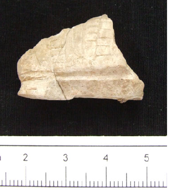 Incised Stone Plaquette Incised stone plaquette: found in flotation sample from compact outdoor surface (Locus 008) in Square AR42 of Area A (Middle Epipalaeolithic in age)
 -
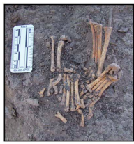 Four Fox Paws Surrounding Worked Flint Bladelet Core Four articulated fox paws surrounding a worked flint bladelet core
 -
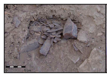 Stone Cache Between Structures 1 and 2 One of the two chipped stone caches located between Structures 1 and 2. Note the addition of a bone point to this lithic cache.
 -
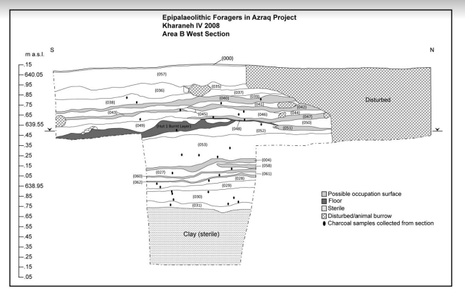 Locus 008 - Area B, Structure 1 Stratigraphic Map West and South section drawings in Area B showing the stratigraphic relationships between Structure 1 and its surrounding deposits. This section was exposed before the horizontal exposure of hut structure 1 by Muheisen’s original sounding in this area
 -
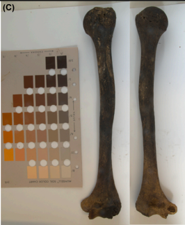 Burn Degree Analysis, Structure 2, Female Burial 4 Detail of the degree of burning evidence on the left humerus from posterior (left) and anterior (right) views.
 -
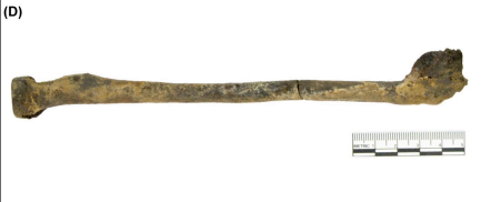 Healed Smith's Fracture and Partial burn, Structure 2, Female Burial 4 Healed Smith’s fracture on the distal right radius, with palmar (anterior) angulation of the distal epiphysis. Partial burning is also evidence on this skeletal element.
 -
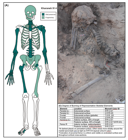 Composition Report Structure 2 Female Burial 4 Inventory and degree of preservation of burial. (A) Visual inventory of skeletal elements preserved. (B) Photograph of the skeleton showing her body position and overall degree of burning of the preserved skeletal elements. (C) Assessment of degree and color of burning of specific skeletal elements.
 -
 (Text Page to) Preface: The Times Atlas of the World. Mid-Century Edition, Edited by John Bartholomew, M.C., M.A. Cartographer by Royal Appointment of the late King George V, Gold Medalist of the Royal Scottish Geographical Society. Volume IV southern Europe and Africa, Containing: Spain, Portugal, Italy, Danube Lands, Greece, Egypt, Mediterranean Islands, North, west, Central and East Africa, South Africa, The Atlantic Ocean. With an Index-Gazetteer. Boston, Houghton Mifflin Company, The Riverside Press Cambridge, 1956.
-
 (Acknowledgments to) The Times Atlas of the World. Mid-Century Edition, Edited by John Bartholomew, M.C., M.A. Cartographer by Royal Appointment of the late King George V, Gold Medalist of the Royal Scottish Geographical Society. Volume IV southern Europe and Africa, Containing: Spain, Portugal, Italy, Danube Lands, Greece, Egypt, Mediterranean Islands, North, west, Central and East Africa, South Africa, The Atlantic Ocean. With an Index-Gazetteer. Boston, Houghton Mifflin Company, The Riverside Press Cambridge, 1956.
-
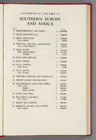 (Contents to) The Times Atlas of the World. Mid-Century Edition, Edited by John Bartholomew, M.C., M.A. Cartographer by Royal Appointment of the late King George V, Gold Medalist of the Royal Scottish Geographical Society. Volume IV southern Europe and Africa, Containing: Spain, Portugal, Italy, Danube Lands, Greece, Egypt, Mediterranean Islands, North, west, Central and East Africa, South Africa, The Atlantic Ocean. With an Index-Gazetteer. Boston, Houghton Mifflin Company, The Riverside Press Cambridge, 1956.
-
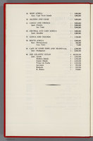 (Contents to) The Times Atlas of the World. Mid-Century Edition, Edited by John Bartholomew, M.C., M.A. Cartographer by Royal Appointment of the late King George V, Gold Medalist of the Royal Scottish Geographical Society. Volume IV southern Europe and Africa, Containing: Spain, Portugal, Italy, Danube Lands, Greece, Egypt, Mediterranean Islands, North, west, Central and East Africa, South Africa, The Atlantic Ocean. With an Index-Gazetteer. Boston, Houghton Mifflin Company, The Riverside Press Cambridge, 1956.
-
 (Covers to) The Times Atlas of the World. Mid-Century Edition, Edited by John Bartholomew, M.C., M.A. Cartographer by Royal Appointment of the late King George V, Gold Medalist of the Royal Scottish Geographical Society. Volume IV southern Europe and Africa, Containing: Spain, Portugal, Italy, Danube Lands, Greece, Egypt, Mediterranean Islands, North, west, Central and East Africa, South Africa, The Atlantic Ocean. With an Index-Gazetteer. Boston, Houghton Mifflin Company, The Riverside Press Cambridge, 1956.
-
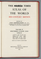 (Title Page to) The Times Atlas of the World. Mid-Century Edition, Edited by John Bartholomew, M.C., M.A. Cartographer by Royal Appointment of the late King George V, Gold Medalist of the Royal Scottish Geographical Society. Volume IV southern Europe and Africa, Containing: Spain, Portugal, Italy, Danube Lands, Greece, Egypt, Mediterranean Islands, North, west, Central and East Africa, South Africa, The Atlantic Ocean. With an Index-Gazetteer. Boston, Houghton Mifflin Company, The Riverside Press Cambridge, 1956.
-
 (Acknowledgments to) The Times Atlas of the World. Mid-Century Edition, Edited by John Bartholomew, M.C., M.A. Cartographer by Royal Appointment of the late King George V, Gold Medalist of the Royal Scottish Geographical Society. Volume IV southern Europe and Africa, Containing: Spain, Portugal, Italy, Danube Lands, Greece, Egypt, Mediterranean Islands, North, west, Central and East Africa, South Africa, The Atlantic Ocean. With an Index-Gazetteer. Boston, Houghton Mifflin Company, The Riverside Press Cambridge, 1956.
-
 (Text Page to) Preface: The Times Atlas of the World. Mid-Century Edition, Edited by John Bartholomew, M.C., M.A. Cartographer by Royal Appointment of the late King George V, Gold Medalist of the Royal Scottish Geographical Society. Volume IV southern Europe and Africa, Containing: Spain, Portugal, Italy, Danube Lands, Greece, Egypt, Mediterranean Islands, North, west, Central and East Africa, South Africa, The Atlantic Ocean. With an Index-Gazetteer. Boston, Houghton Mifflin Company, The Riverside Press Cambridge, 1956.
-
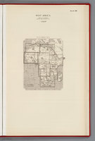 (Index to) West Africa. Lambert's Zenithal Equal-Area Projection, 1:5,000,000.
-
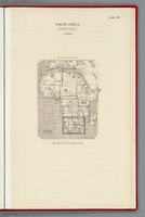 (Index to) South Africa. Lambert's Zenithal Equal-Area Projection, 1:5,000,000.
-
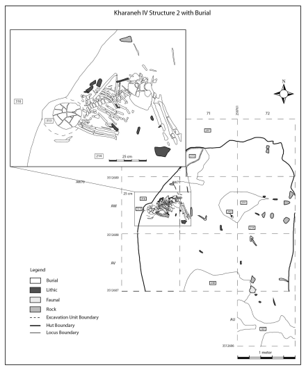 Structure 2 Burial Map Detailed plan of Structure 2, showing the location and position of the human remains along the western wall of the structure.
 -
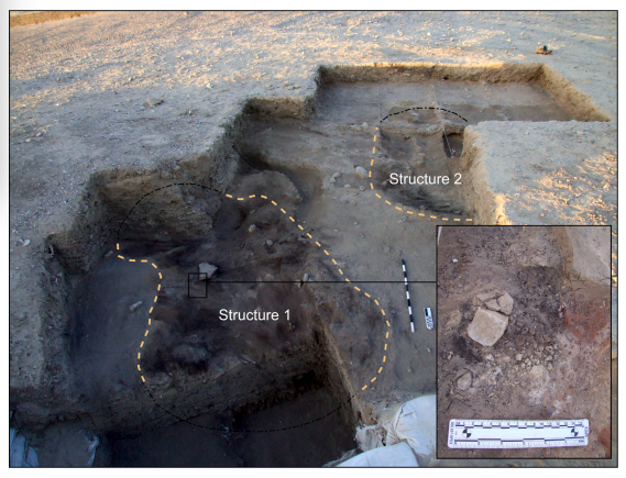 Structures 1 and 2 Oblique plan view of Structures 1 and 2. Photograph of Structure 1 just prior to its excavation, showing the extent of the burnt and mottled superstructure sediments overlying the hut structure floors and associated deposits. Structure 2 is visible in the background, only partially exposed, but not yet excavated. Inset is one of the three caches of marine shells and red ochre found on top of the burnt layer. These were placed beside a large flat stone visible in top right corner of the inset photo.
 -
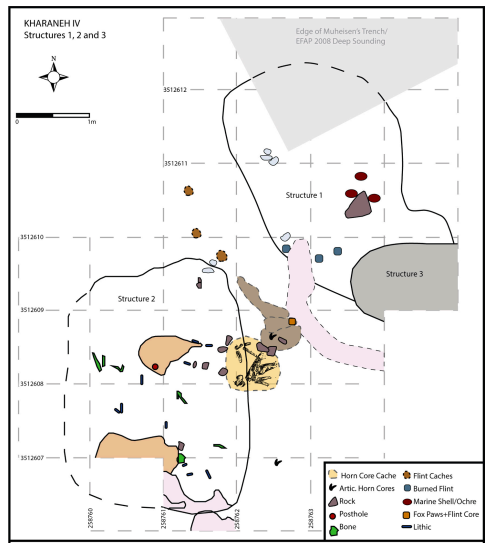 Site features Map Plan view (top) of Structures 1 and 2, and section view (bottom) of Structure 1. Top: Simplified plan views of Structures 1 and 2, showing their proximity to each other, as well as several caches of flint, a cache of burnt horn cores, and a large hearth in between the two structures. Caches of marine shell, and bone and flint are also noted within each structure. Bottom: Section of Structure 1 showing the covering orange sand, burnt superstructure and three superimposed, compact floors, and photographs of articulated aurochs vertebrae found on the uppermost floor (left), marine shell and red ochre cache from the burnt layer (center), and burnt flint nodules in the burnt layer visible as the orange capping sand layer is removed (right).
 -
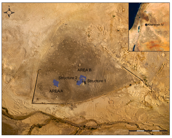 Site Areas Map Aerial photograph of the Epipalaeolithic site of Kharaneh IV. This overview of the site documents the extent of the site shown as the darkened chipped stone pavement on its surface. The Wadi Kharaneh is visible in the foreground, to the south of the site, and contemporary military berms are visible to the east and north. The location of Kharaneh IV within the southern Levant is shown inset. The extent of excavations areas A and B are shown by the highlighted areas, and arrows point to the locations of Structures 1 and 2.
 -
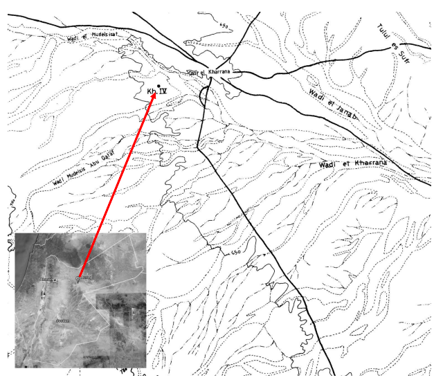 Locus Map 1 Map showing Kharaneh IV. Adapted from Muheisen 1988, 354 and Google Earth.