-
Title
-
Eng
(Contents to) The Times Atlas of the World. Mid-Century Edition, Edited by John Bartholomew, M.C., M.A. Cartographer by Royal Appointment of the late King George V, Gold Medalist of the Royal Scottish Geographical Society. Volume IV southern Europe and Africa, Containing: Spain, Portugal, Italy, Danube Lands, Greece, Egypt, Mediterranean Islands, North, west, Central and East Africa, South Africa, The Atlantic Ocean. With an Index-Gazetteer. Boston, Houghton Mifflin Company, The Riverside Press Cambridge, 1956.
-
Eng
The Times Atlas of the World. Mid-Century Edition, Edited by John Bartholomew, M.C., LL.D. Cartographer by Royal Appointment of the late King George V, Gold Medalist of the Royal Scottish Geographical Society. Volume II, South-West Asia & Russia, containing Afghanistan, Arabia, Arctic Ocean, Ceylon, Greenland, India, Indian Ocean, Iraq, Israel, Jordan, Lebanon, Pakistan, Syria, Turkey, and the Union of Soviet Socialist Republic, etc. With an Index-Gazetteer. Boston, Houghton Mifflin Company, The Riverside Press Cambridge, 1959.
-
Eng
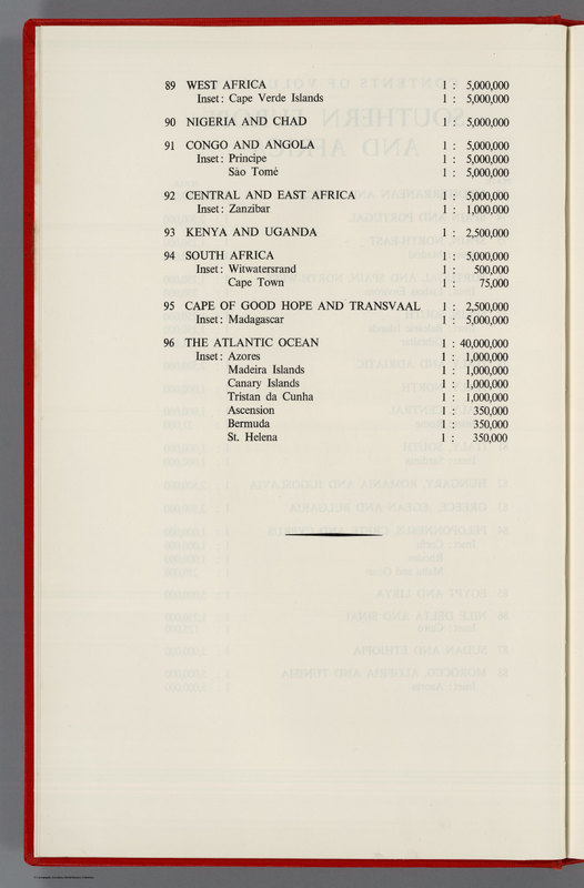
Contents: (Continues) Contents of volume IV, Southern Europe and Africa
-
Subject
-
Eng
Volume IV, the second to appear in the series of five volumes which will comprise the Mid-Century Edition of the Times Atlas. Full color maps, xii, and 24 leaves of plates. Bound in red linen, with label stamped in real gold reading "The Times Atlas of the World, Southern Europe & Africa Volume IV."
-
Eng
Published in 5 volumes, 1955-1959, with 122 colored double page map sheets, and a comprehensive index of over 200,000 names. Because of the long production times involved in the work of compiling the detailed maps. The volumes were arranged in continental groupings with volume III, North Europe, coming out first, followed by another volume each year. V.1. The World, Australasia & East Asia --V.2. South-West Asia & Russia --V.3. Northern Europe --V.4. Southern Europe & Africa --V.5. The Americas. with an Index-Gazetteer. Bound in red linen, with label stamped in real gold reading "The Times Atlas of the World, Mid-Century Edition."
-
Creator
-
Eng
Bartholomew, John
-
Eng
William Clowes & Son Ltd
-
Medium
-
Eng
image
-
Temporal Coverage
-
Eng
1956-1959
-
Access Rights
-
Eng
David Rumsey
-
Eng
http://dp.la/api/contributor/david_rumsey
-
Source
-
Eng
David Rumsey Map Collection
-
Eng
The historical map collection has over 38,000 maps and images online. The collection focuses on rare 18th and 19th century North American and South American maps and other cartographic materials. Historic maps of the World, Europe, Asia, and Africa are also represented.
-
Eng
Houghton Mifflin Co
-
Eng
John Bartholomew & Son LTD
-
Eng
Boston
-
Eng
London
-
Relation
-
Eng
1552.000
-
Rights
-
Eng
Creative Commons Attribution-NonCommercial-ShareAlike 3.0 Unported

